Pandemic walks extentification project

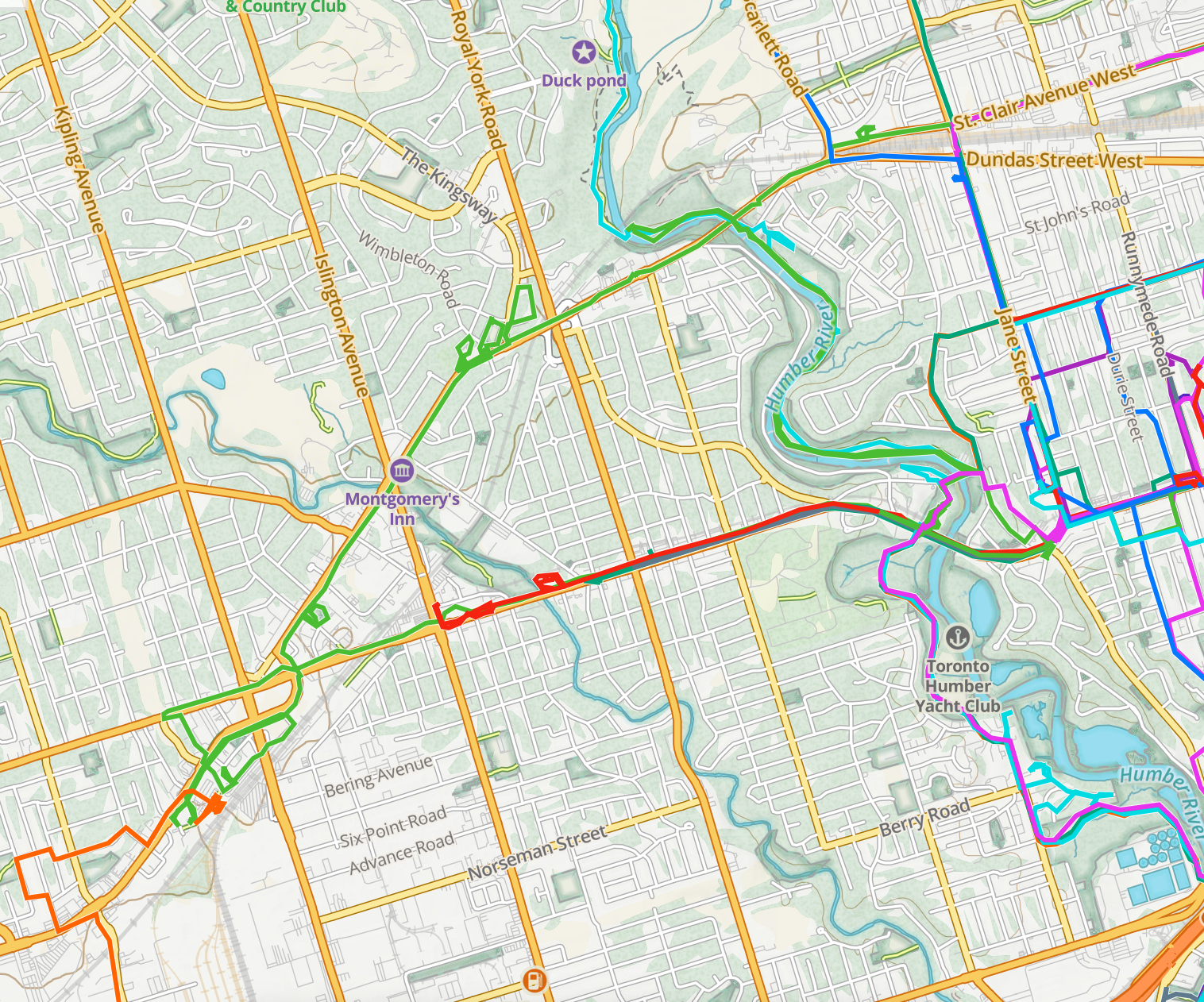
My pandemic walks project has involved a lot of densification: trying to exhaustively make use of all possible routes within a geographic area, acting as a kind of human radioactive tracer running through the city’s circulatory system.

This has been interesting and has led to some nice still and animated art.

At the same time, the whole project was motivated in part by the desire to avoid visiting and re-visiting the same areas during the pandemic. That, combined with pleasant spring weather, has me thinking about reorienting from densification toward extentification, both undertaking new rides to expand the total area explored and working to add days with over 100 km of riding.

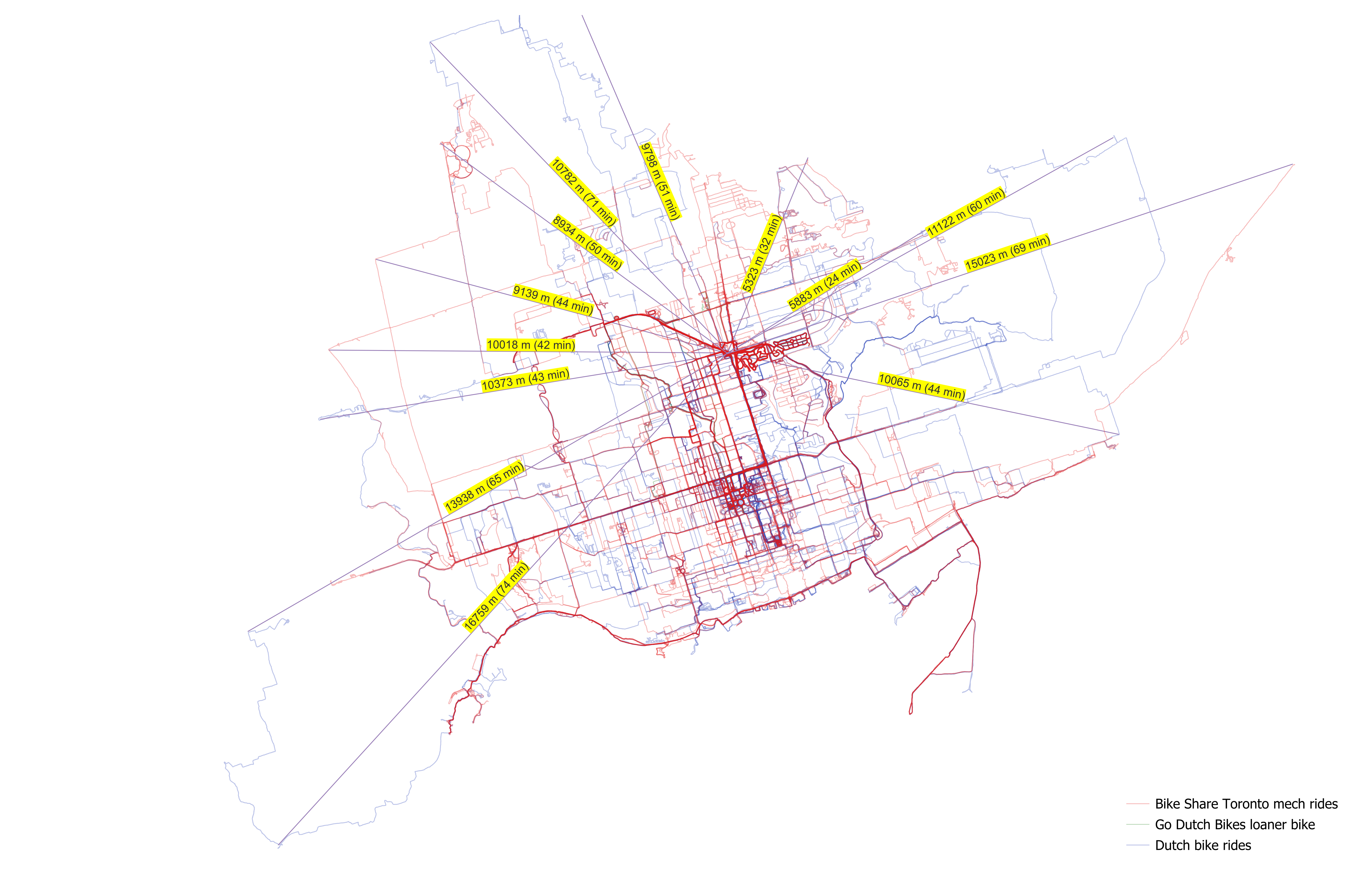
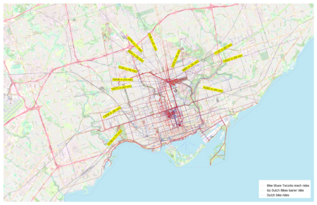
I made some maps to get a sense of how long it would take to get beyond the explored region. I added lines to show the distances to places on the outermost edges of the explored area and, in parentheses, added the Google Maps bicycle travel times there from Brentwood Towers:

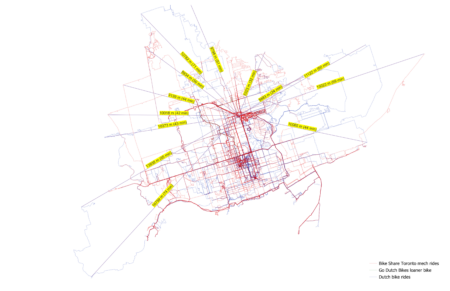
(Sorry the travel times are glitched in the final map; I wanted to make all the lines the same colour and accidentally overwrote the manual Google Maps travel times labels.)

These maps show only analog / mechanical / acoustic bicycle trips, including my year on Bike Share Toronto, my Dutch bike, and the loaner I used while it was being serviced.

I need to go a long way in most directions to get beyond the network: 10–15 km in most directions. The most direct route to new kilometres is northeast, through the Bridle Path and into the areas east of the northwestern branches of the Don.

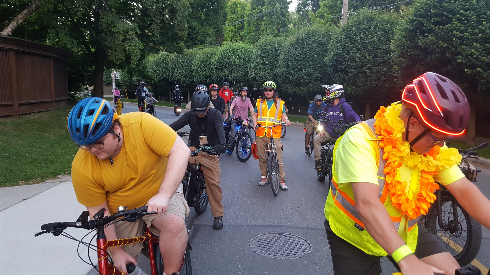
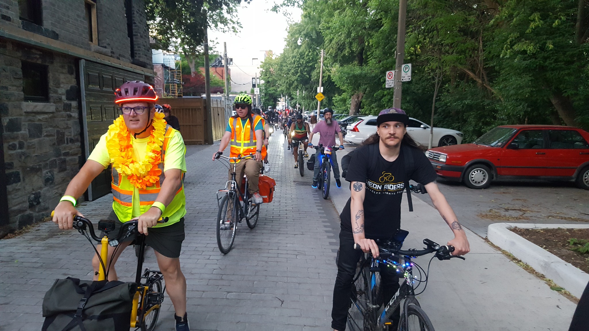
The 10,000 milli-amp-hour portable phone battery which I bought for the 2015 CUPE 3902 TA strike at U of T had started bulging, so I replaced it. I should be set for day-long extentification weekend excursions now.

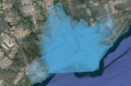
P.S. I figured out how to do this in a more automated way using QGIS. First, here is the area of all the rides converted into convex hulls:

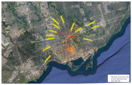
And here is a set of automatically-generated spokes radiating in all directions from the centre point of all my rides (which is predictably enough right between home and work):

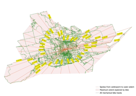
The only buggy element is how it projects spokes out into the lake. Nonetheless, this provides a useful visual guide to how far I need to go to get beyond my total area explored so far by bike.

Cherry blossom season-starter

Last night, the Neon Riders began their 2025 season with a tour of Toronto’s varied blooming cherry blossoms:

These rides are one of the definite high points of my week. Riding in a large group is a totally different experience from riding in the city alone — as long as you are not at the edges you barely need to worry about cars, which is an inversion of the normal city cycling experience, and the rides are fundamentally social since you are always surrounded by people who you can speak to easily and naturally.

Plus, there are bike dogs:

Photos from the Yellowknife drive

In the summer of 2003, I broke with my long avoidance of air travel so that I could first help my brother Sasha move from Behchokǫ̀, in the Northwest Territories near Yellowknife, back to Victoria, BC.

We did the drive through a vast terrain of wildfires in three intensive days, with Sasha driving.

I had been meaning for ages to get our photos processed, but because of the financial pain of the long PhD all my computers and software are quite obselete and were unable to handle the RAW files from his specific Fuji camera.

I have finally figured a workaround using Adobe’s digital negative (DNG) format, so now the photos are up.

Living across the country and avoiding flying, I have seen far too little of my brothers in recent years. I justified it because I thought I was living my values by making lifestyle choices to reduce my climate impact, and because I still hoped humanity might be reaching a level of understanding where we take the crisis seriously and respond in a useful and adaptive way.

Now I think I need to do a complete re-evaluation of what sort of political project makes sense. Ever since I first became involved in environmentalism in the 1990s, I had thought that eventually the universal experience of how the world is changing in frightening ways would make people willing to make changes themselves. Now, I really don’t know.

Still, I am immensely grateful that I got to spend this intensive time with Sasha and that our relationship is still deep and meaningful after years of almost exclusively telecommunicating. His integrity and determination are inspirations to me, and I try to draw from his example while trying to live my own life well.

Related:

Two October trips

This is going to be a packed month.

For Thanksgiving weekend, I am going on a camping trip with friends to do some trail repair near Temagami.

Then, from the 24th to 27th, I am photographing a diplomatic conference in Montreal.

Both will require a fair bit of packing and preparation, and I expect a week or so of evenings spent post-processing the Montreal photos after work when I return.

Toronto is a bike city

A friend from the Toronto group bike ride community directed me to Jeff Allen’s intringuing and beautiful cartographic work.

One especially striking map – which supports my view that bicycling has become the best and fastest form of transport in Toronto – shows which areas it is faster to reach from Yonge-Bloor by bike than by transit during rush hour:

You can get a long way! Straight north to York Mills. Southwest past the mouth of the Humber. Southeast past Tommy Thomson Park and into Scarborough.

The map is from 2016, but I would imagine things are worse now with transit underfunding and all the slowdown zones, plus all the streets blocked up by summer construction.