
Category: Exercise
Podcasts and audiobooks
Because the spoken word content on Spotify is so-so most of the time (aside from podcasts like Ologies and the Spycast), I have been trying Audible to provide better quality listening material during walks.
So far I have finished James Donovan’s book “Strangers on a Bridge: The Case of Colonel Abel” about the espionage trials and eventual prisoner exchange of a KGB colonel living as an illegal in New York (also depicted in the excellent film Bridge of Spies) and Lyndsay Faye’s “Dust and Shadow: An Account of the Ripper Killings by Dr. John H. Watson” which I learned about from an interview with the author on the I Hear of Sherlock Everywhere podcast and then finished in two days.
Donovan’s book was quite interesting, if read a bit mechanically. Faye’s book is a great pastiche, interestingly written with both deep knowledge of the canon and a willingness to innovate, and very well read in this edition.
Over several weeks I have listened to the first half of “Anna Karenina” read by Maggie Gyllenhaal, which is superb. She brings a great saucy enthusiasm to the text and language, and it’s easy to imagine that one is being read to by her character from the film Secretary.
Finally, in the hope of better understanding American conservatism in order to better strategize about climate change, I have been listening to Geoffrey Kabaservice’s “Rule and Ruin: The Downfall of Moderation and the Destruction of the Republican Party, from Eisenhower to the Tea Party.” I’m still working through the 1960s, which is still fairly little-known history to me. The book is a bit challenging both because a lot of the names and events are unfamiliar and because the narrator is a bit monotone in a way that tends to enhance the difficulty of paying attention.
I found that such narration was commonplace in the books and spoken word content on Spotify, so generally I have been very happy about how Audible has shifted my listening toward fully accomplished published works with enduring social importance, rather than just the (sometimes excellent) present-focused podcast and news content.
Snow hiking

Birthday hike
Walking the Humber north of Old Mill
Beltline Trail
Open thread: Urban thru hiking
Apparently it’s something that’s starting to exist:
Day hiking within city limits isn’t a new concept, of course. There are guidebooks detailing trails in cities from San Francisco to Atlanta. But Thomas has pushed the pursuit further, mapping out routes as long as 200 miles from one corner of a city to another and using infrastructure like stairways and public art to rack up elevation gain and provide something approximating a vista. She started in 2013 with a 220-mile through-hike in Los Angeles called the Inman 300, named for one of its creators, Bob Inman, and the initial number of stairways it included. Among other efforts, she has since hiked 60 miles through Chicago, 200 miles in Seattle, and 210 miles in Portland, Oregon. In 2015, she trekked the 54 miles from Selma to Montgomery, Alabama, on the 50th anniversary of that historic civil rights march.
The way I see it, urban thru hiking lets you walk more comfortably with less gear since you never need to make camp. Routes that amount to a serious sustained hike can be added up from segments which avoid car traffic as much as possible, and which link up with public transit to let you get home at the end of the day and back at the trailhead easily the next one.
Related:
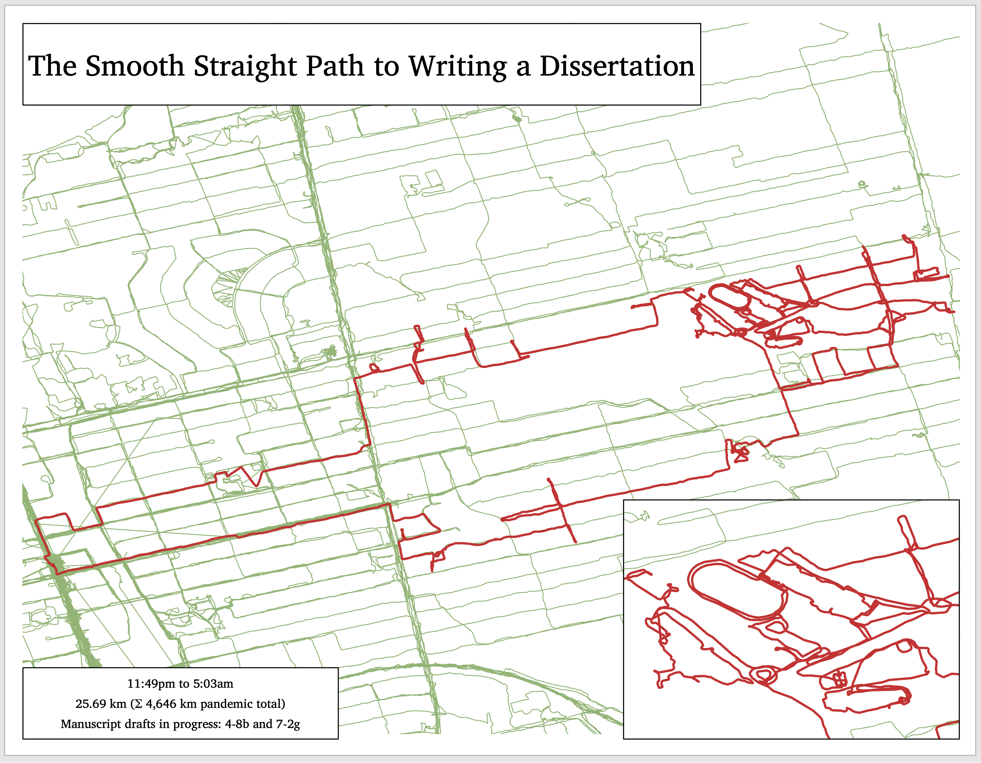
Pandemic walk heat maps
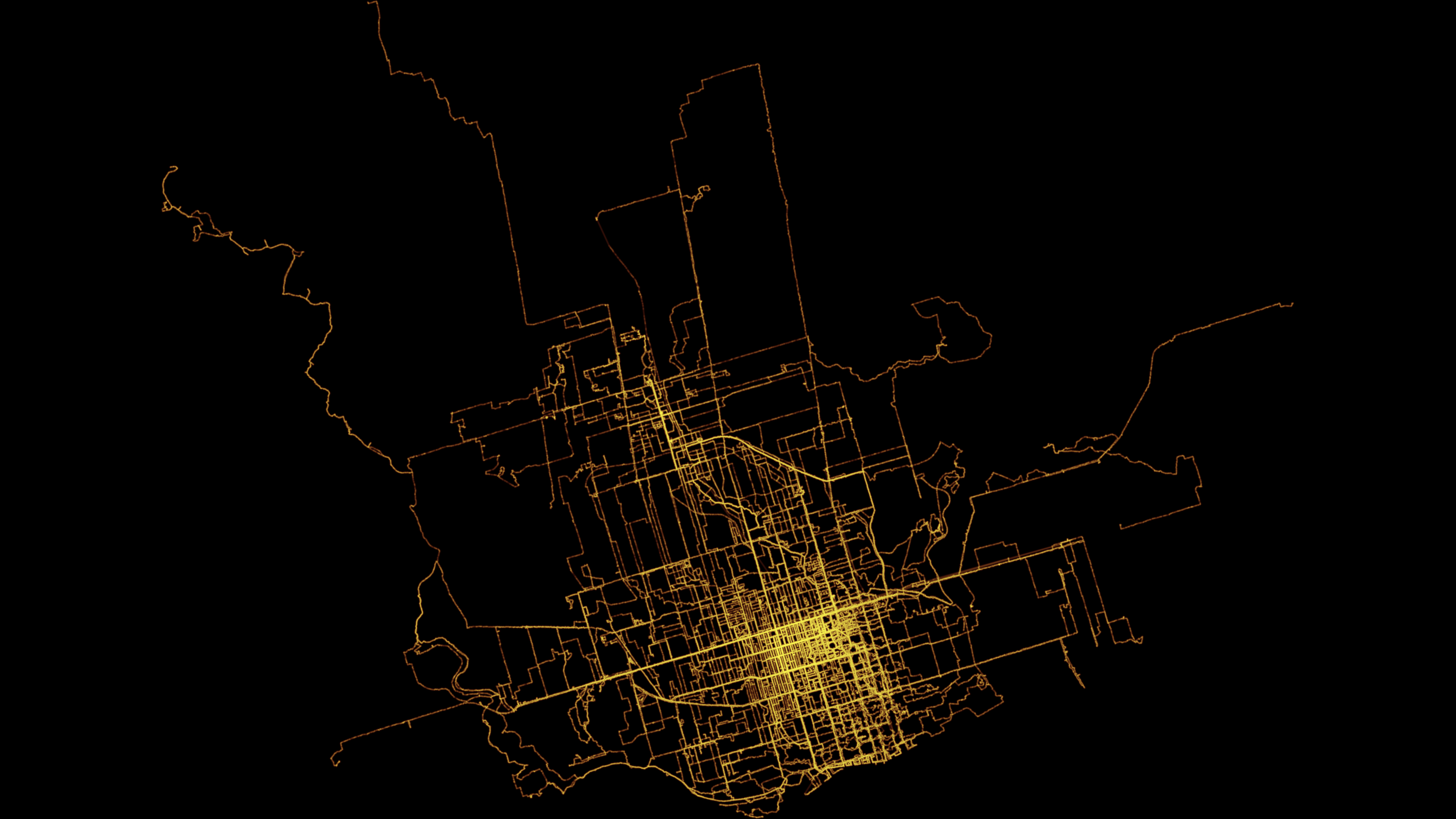
As part of playing around with my GPS data from my exercise walks since I wanted to make a heat map showing the likelihood of being in any particular place.
Here’s one I made using Seth Golub’s heatmap.py Python script (radius 5, decay 0.75):
I also made one in QGIS. First I converted the tracks to a set of points in a CSV file. Then I created a spatial index of the point layer, created a hexagonal grid of polygons of a sensible size, and counted the number of points in each. Then I rendered that as brighter or darker hexagons:
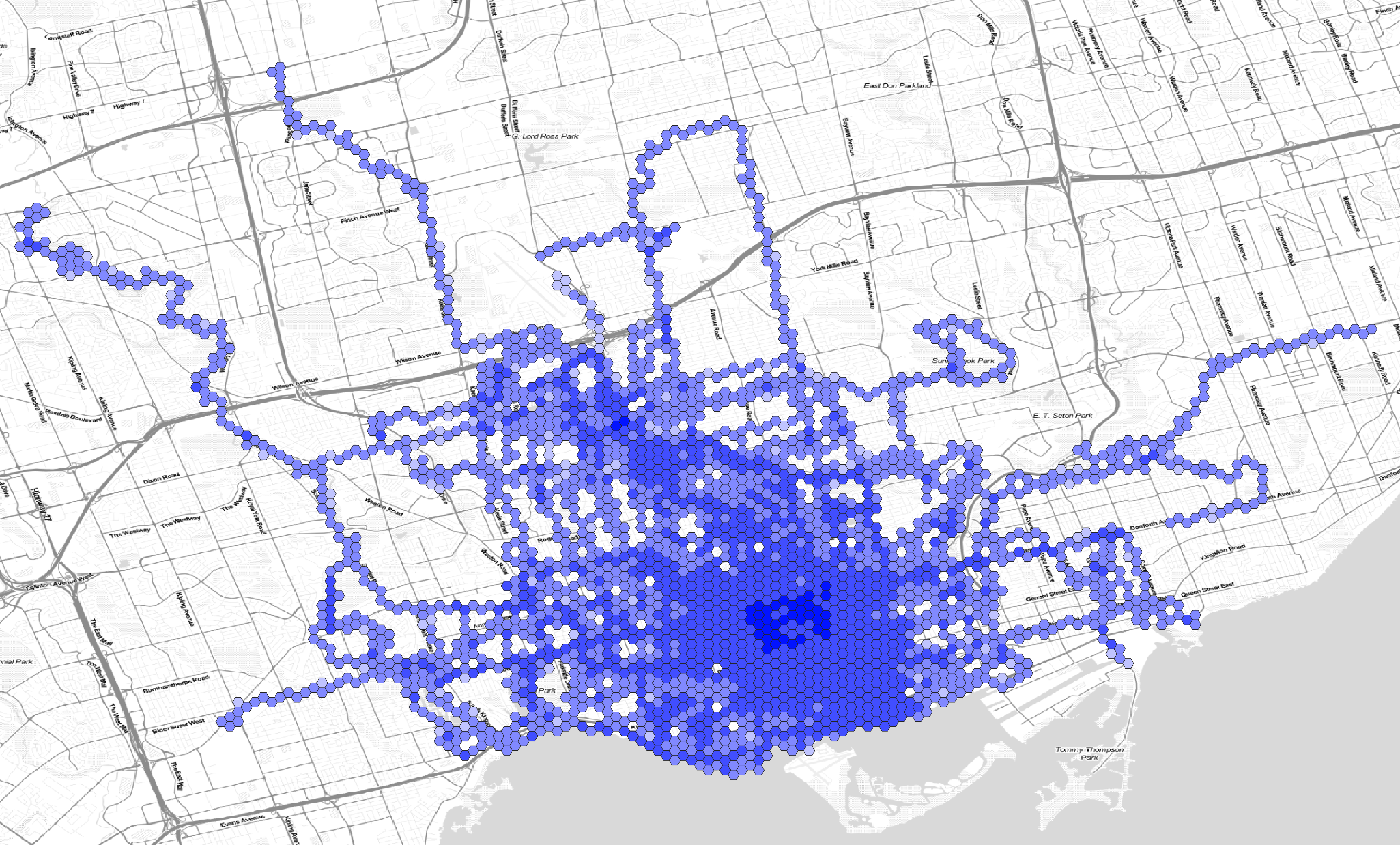
Here are the hexagons semi-transparent and rendered on a faux watercolour of the Toronto area:
![]()
The walks have sometimes been lonely and sometimes been scary, but they have been the main thing getting me out of the house and providing exercise during the pandemic. They do make me feel like I have a broader understanding of the city, though walking through a neighbourhood at night with headphones on only gives you a certain kind of perception.
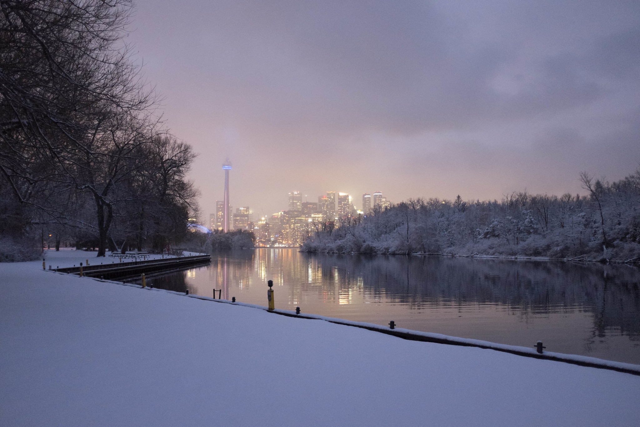
Night hike
At 9pm yesterday, I decided that I couldn’t focus enough for thesis work and to take a walk. My friend Tristan had recently plotted out some hiking routes on my computer, including one up the Don Valley from Old Mill station, crossing over east near Sheppard, then north up the Black Creek trail.
I wanted to see how accessible the start point is from my new place by foot, and then when I got there I decided to try the up-river segment. I got to Sheppard and carried on upriver, past Finch and ultimately as far as Thackeray Park. When I got to a fence blocking further progress, I saw that I had gone 24 km. I hadn’t been particularly planning anything, including a long walk, and I didn’t have any food or water with me or anywhere to buy them in the Humber Valley, but I felt fresh and like I could do the same distance again. So I decided to redo the river path south to where I entered the valley, then continue south to Old Mill station. After figuring that getting to Old Mill would put me around 43-4 km of walking, I decided that if my feet felt up to it then I would walk enough along the Bloor subway line to push it past 50 km:
This ended up being my longest walk of the pandemic so far, but it was around 7 ˚C and dark and I felt comfortable in just a puffer and wool buff and never thirsty. I also saw virtually nobody on the path until I started to see exercise keeners after 6:30 – 7:00am. I don’t think I saw anybody on foot or close by between entering the valley and reaching the scenic view of the railway bridge just north of Dundas Street West.
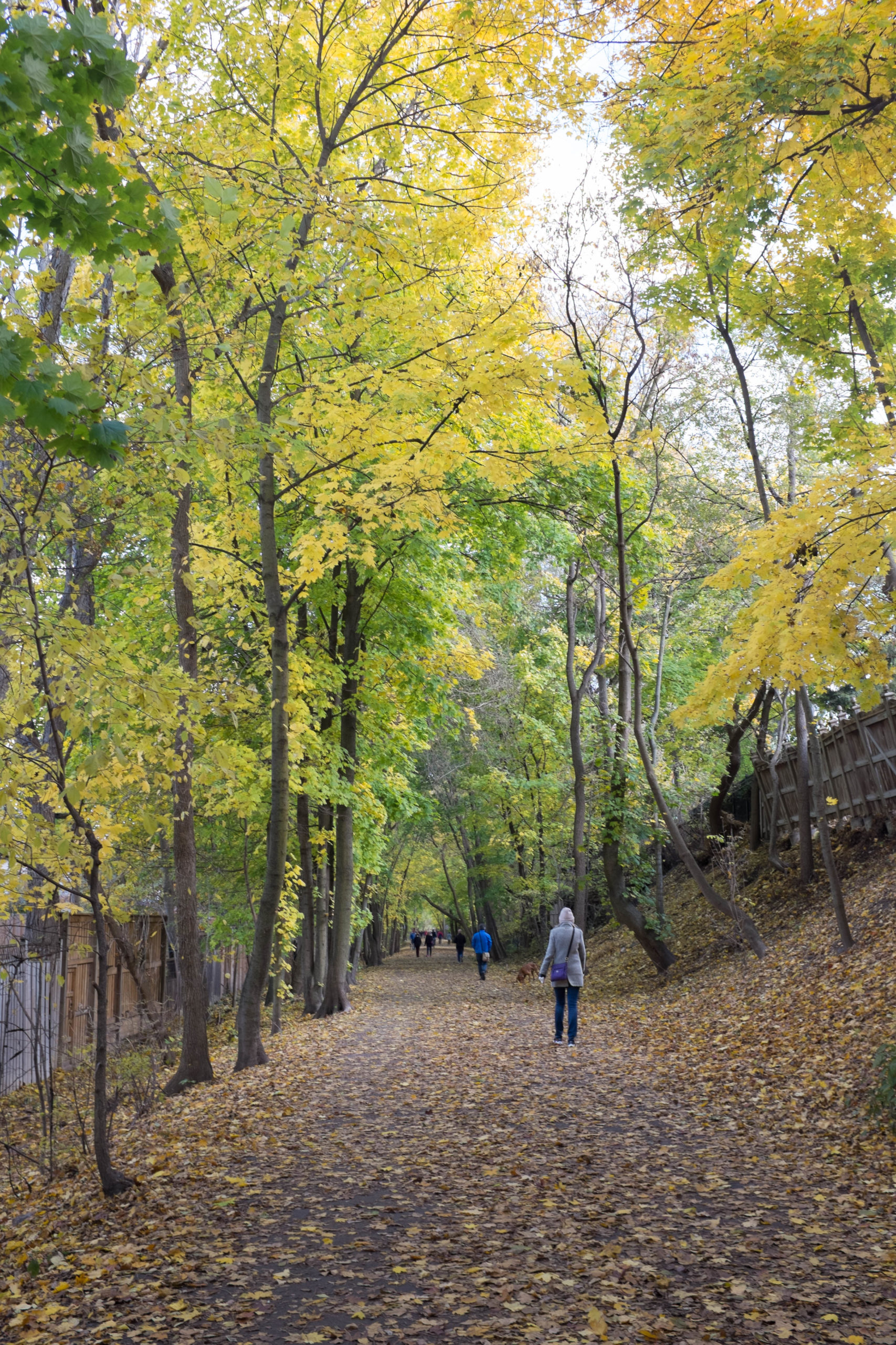
The whole route is marked by deep forest on either side (by Toronto standards), some magnificent willows along the riverfront just north of Lawrence Avenues, and a whole series of pedestrian bridges big and small used to cross the river while following the path.
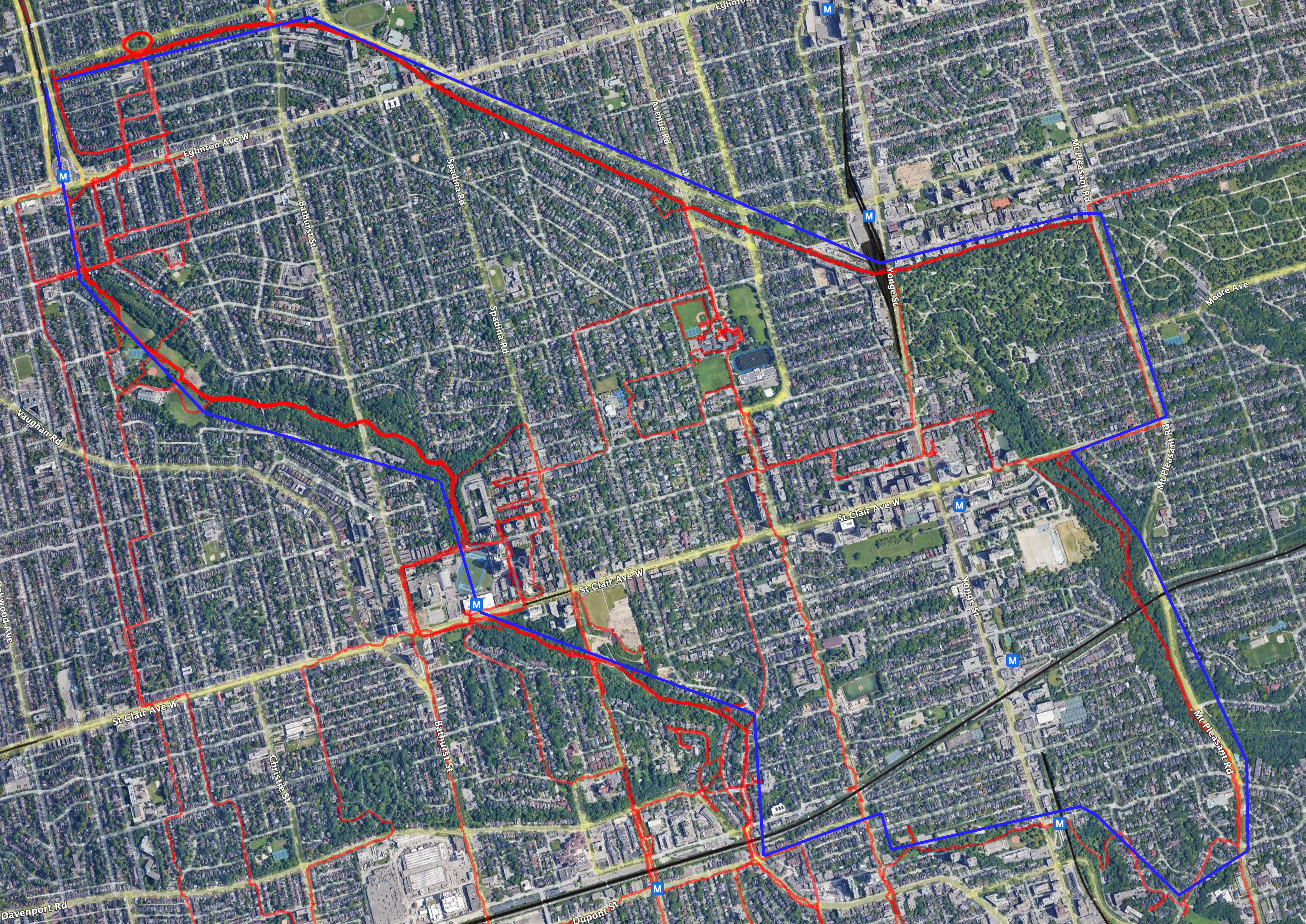
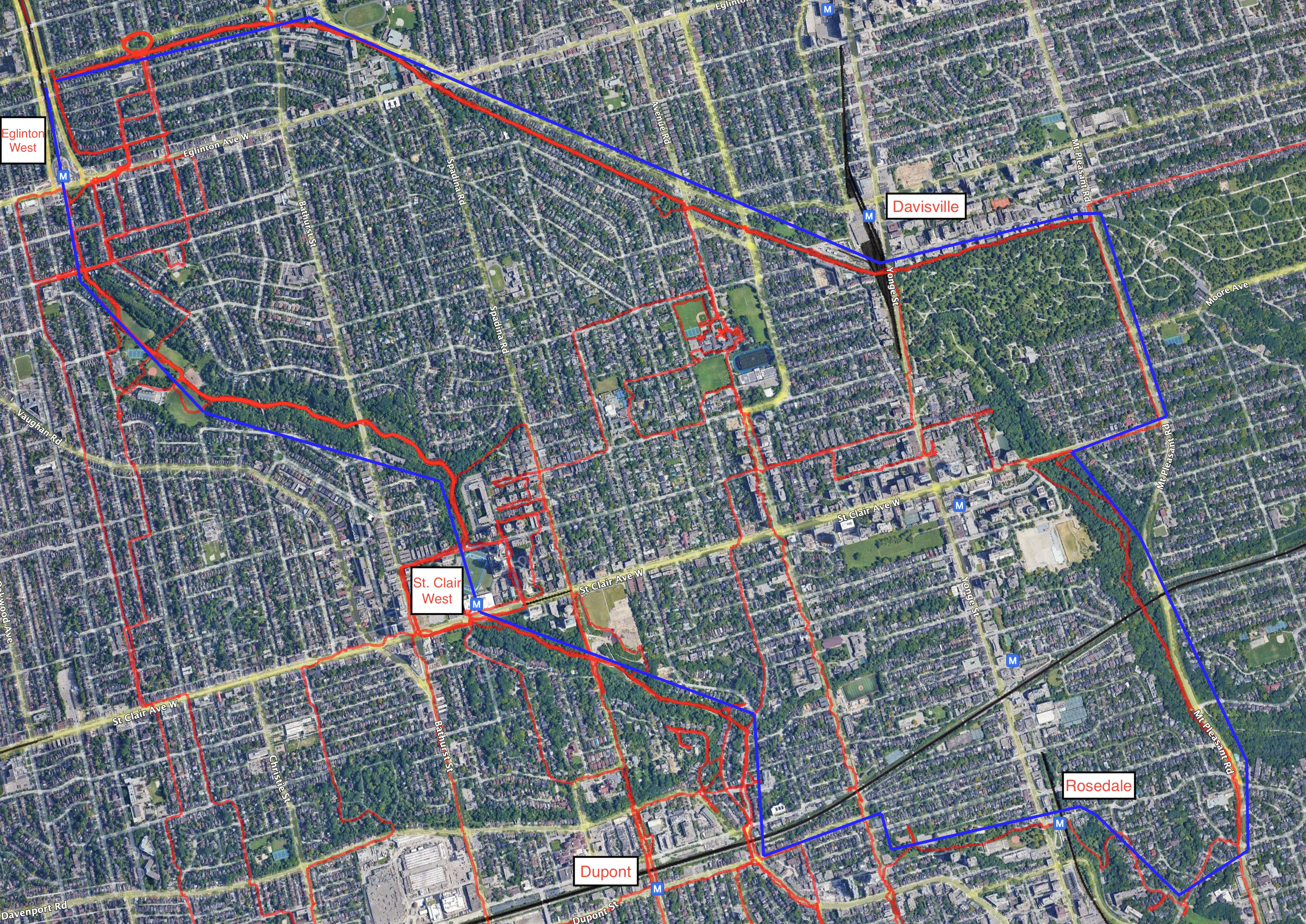
The Toronto Cyclone trail
During the course of my pandemic walks, I started looking for anything green in the map of Toronto and undertaking walks to explore those areas. Eventually, I realized that several green areas can be strung together into an urban walking trail that is mostly separated from cars. I think of it as a bit equivalent to Vancouver’s Seawall as a place to get exercise in a natural surrounding without having to worry about too many cars.
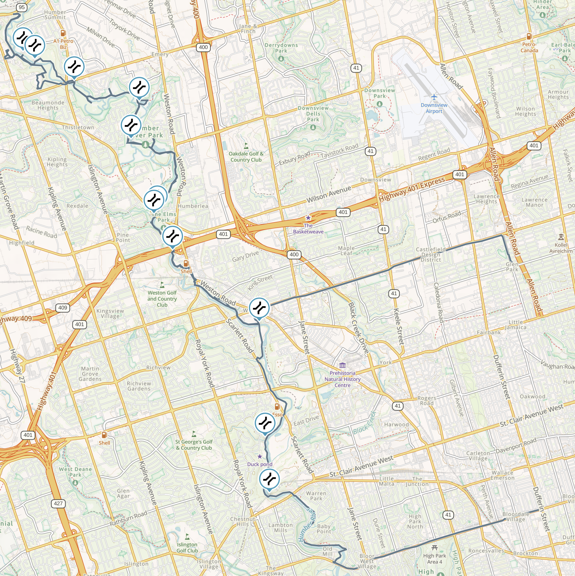
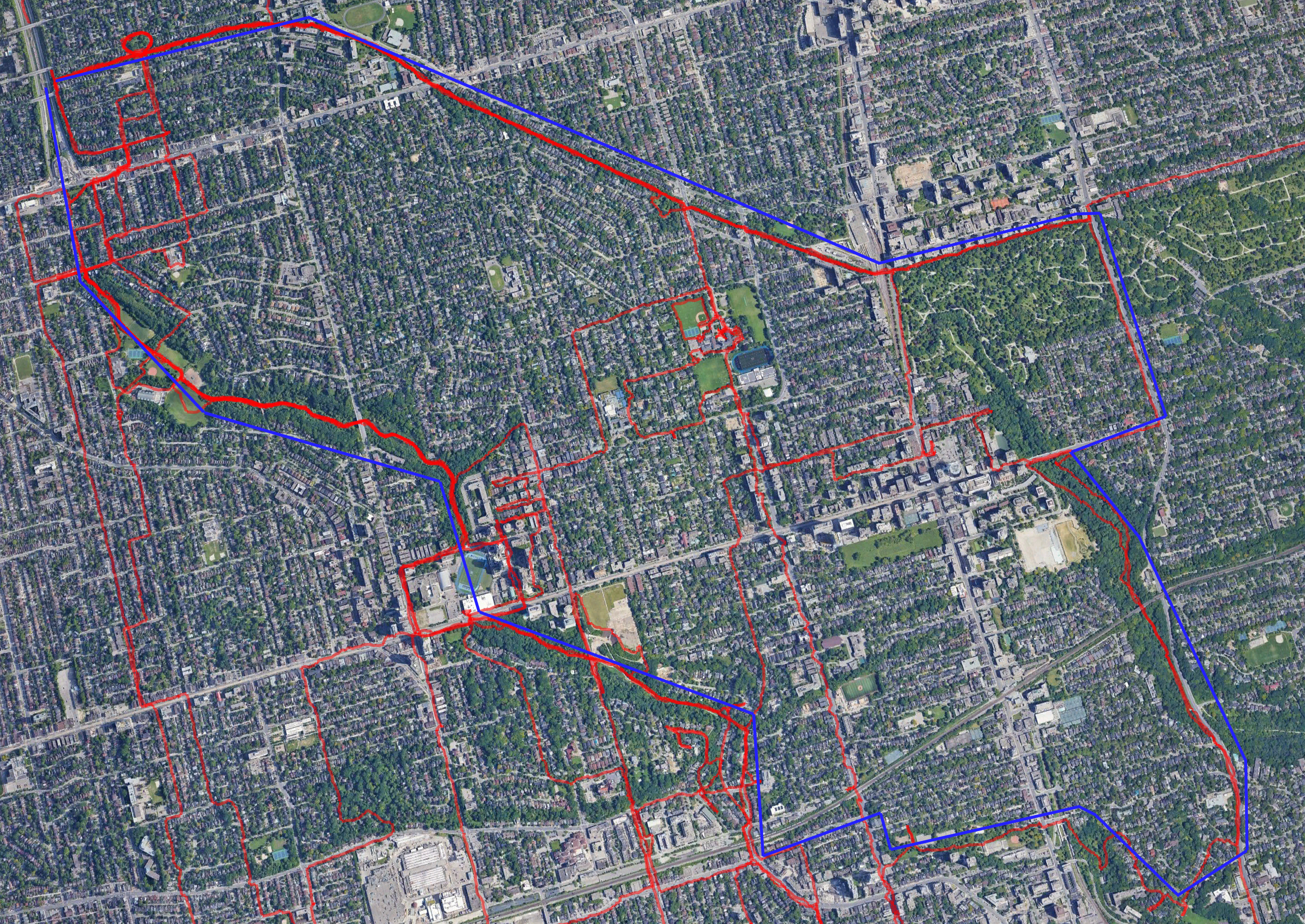
The Cyclone route includes the Beltline trail, the Nordheimer and Cedarvale ravines, and a route through Rosedale and the Mount Pleasant cemetery back to the eastern end of the Beltline. The route is easy to get on and off, as it passes near five subway stations:
Map: no road labels, road labels, road and subway labels.
The approximate path of the main route is in blue on those maps, and actual tracks of GPS data are red.
I began calling the trail The Cyclone in December 2020 and have shared it with family and friend. I was surprised yesterday to come across a tweet describing much the same route.