
Category: The outdoors
Hiking, camping, canoeing – if it’s an outdoor adventure, it should be under this heading
Toronto’s bike season re-emerging
Snowbanks are still dwindling and another winter blast is still expected, but I was nonetheless able to ride my bike every day from Saturday through Monday.
Official Neon Rides likely won’t resume until April, but if attractive weather warrants it we might undertake some unofficial rides sooner. For me, that would represent the re-emergence of a social community which I have badly missed through the winter’s flurries and pools of slushy brine.
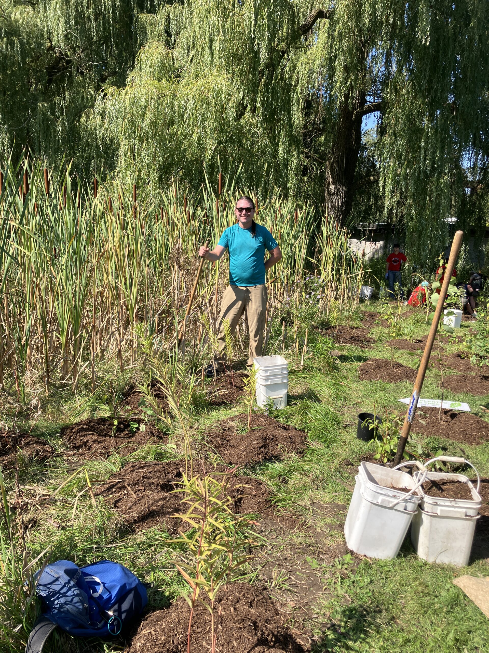
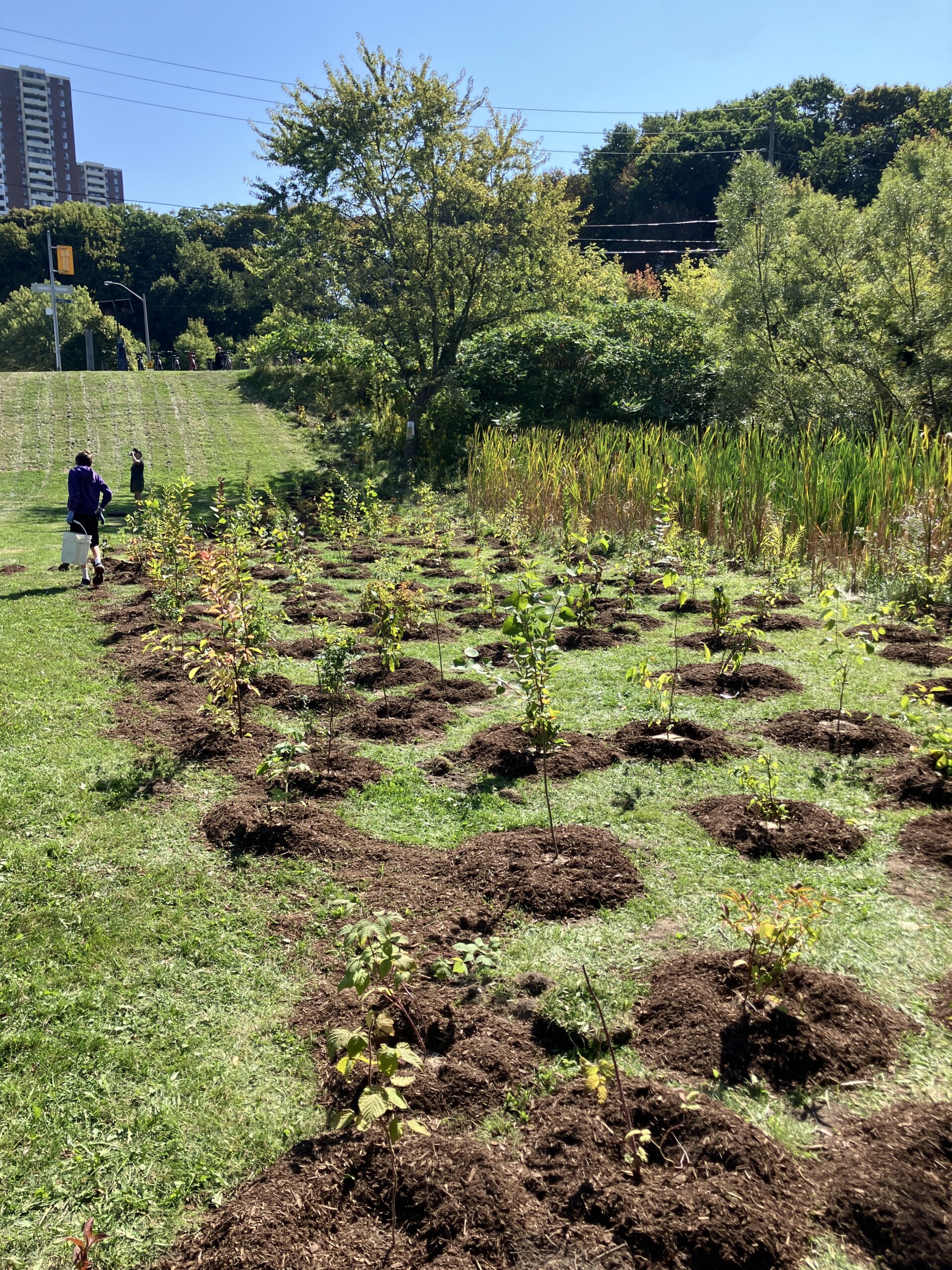
Meadoway 2025 report
I have been suffering for a week from a vexing stomach bug that has had me living on nothing but an hourly soda cracker and oral rehydration salts.
It has nonetheless been very exciting to read about the excellent work being done by the Meadoway project, in which a 16 km stretch of hydro corridor has been turned into a giant re-naturalization project. The corridor runs all the way from the eastern edge of the Don Valley to the Rouge and Toronto Zoo area.
Their 2025 annual report is detailed, beautifully illustrated, and inspiring. Toronto has a great opportunity to add new ways of getting around the city on foot and by bike, avoiding cars, while achieving all the erosion and biological benefits of re-introducing native plants at scale.
Their restoration manual is highly interesting too, and shows a laudable desire to share lessons with everybody.
As soon as ground conditions, weather, and health allow, I want to take my first real bike trip of the year to see the early emergence of the plants of interest out in Scarborough.
Watching the snow fall
Winter has fallen decisively across Toronto. Right now it’s longjohns-and-a-toque weather inside my small apartment, with nothing but white to see at any distance outside the windows.
I brought my bike in for an annual tune-up, plus a shifter repair and replacement tires. I don’t expect much biking for several months, but it was good to get it into the shop during their less busy time. I’m getting an upgrade to Schwalbe Marathon Plus tires, which the staff say are good for puncture resistance, plus replacing the seat which is gradually eroding away with a more comfortable and better one.
I am looking forward enormously to the return of bicycling season. The city seems so much more open and endowed with possibility when it is possible to get anywhere without worrying about TTC delays or deep snow banks.
Foreward to Stroll
A new, cool style of engaging and enjoying metropolitan realities has recently emerged in Toronto among certain young writers, artists, architects, and persons without portfolio. These people can be recognized by their careful gaze at things most others ignore: places off the tourist map of Toronto’s notable sights, the clutter of sidewalk signage and graffiti, the grain inscribed on the urban surface by the drift of populations and the cuts of fashion.
Their typical tactic is the stroll. The typical product of strolling is knowledge that cannot be acquired merely by studying maps, guidebooks, and statistics. Rather, it is a matter of the body, knowing the city by pacing off its streets and neighbourhoods, recovering the deep, enduring traces of our inhabitation by encountering directly the fabric of buildings and the legends we have built here during the last two centuries. Some of these strollers, including Shawn Micallef, have joined forces to make Spacing magazine. But Shawn has done more than that. He has recorded his strolls in EYE WEEKLY, and these meditations, in turn, have provided the raw material for the present book. The result you have in your hands is a new introduction to Toronto as it reveals itself to the patient walker, and an invitation to walk abroad on our own errands of discovery, uncovering the memories, codes, and messages hidden in the text that is our city.
Foreward from first edition, Toronto, 2010
John Bentley Mays, 1941–2016
Micallef, Shawn. Stroll: Psychogeographic Walking Tours of Toronto. Updated Edition. Coach House Press, 2024. p. 7
Planting with the city
First time at Biidaasige Park
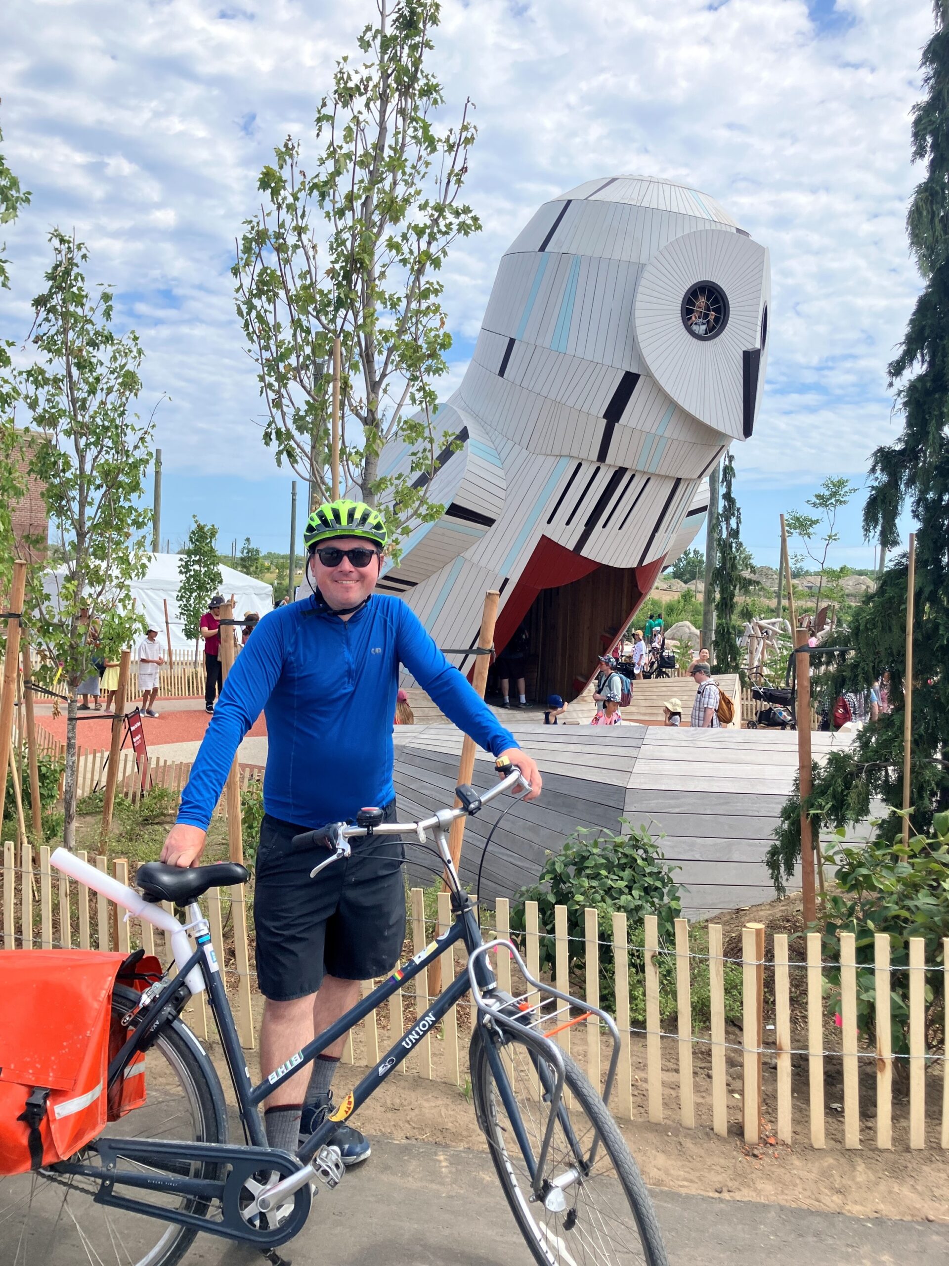
Photo by Jess
I had a great Saturday. It was cool enough not to be oppressive, and I was able to ride down the Don past the Brickworks to the new Biidaasige (bee-daw-sih-geh) Park. The park is very impressive. They have turned the engineered, industrial, concrete landscape around the mouth of the Don River into a real human space again, and an alluring one. There is a large outdoor adventure playground with ziplines, charmingly rendered animal play sculptures, and two-story high treehouses shaped like a raccoon and an owl, the latter of which has a tiny amphitheater in front. Within a large landscape of springy concrete, kids can use human-powered pumps to move water into a simulated watershed with controllable floodgates and sand areas to play in. There are curving paths along the new rivercourse, which is lined thickly with native plants. There are also boat launches and fishing spots.
The park grand opening was happening just a short ride from the Neon Riders BBQ, so I was able to see some friends there and bring one back for another ride through Biidaasige Park. After that, another friend from the Riders had a charmingly creative and playful music gig in Bickford Park, which was further enriched for me by a pair of very friendly dogs who were part of the small audience.
A river mouth should be a geographical anchor and natural point of interest. As someone who has walked extensively all over Toronto, the way the Don came to an end failed to satisfy those expectations. With Corktown Common, Biidaasige Park, and the other park areas still in progress, the city is doing a great job at making the river mouth part of the human landscape again. I have thought for years that Toronto’s greatest planning blunder was cutting off the city from the lake with the Gardiner Expressway. Personally, I would be fine with getting rid of the whole thing through the mechanism of less driving downtown, but while we are waiting it’s great that at least the river is being reclaimed.
The ziplines all had long lines of small children on Saturday, so I will need to return when things are less crowded. I expect Biidaasige Park to become a popular break spot for Neon Rides.
P.S. At an arts and crafts station, I was taught to make ‘seed bombs’ out of dirt, pottery clay, and heirloom open-pollinated seeds of Common Evening Primrose (Oenothera lamarckiana) from the Ecoseedbank in Montreal. The flowers are native to the region and good for pollinators, and the initiative reminds me of charming videos of dogs who help re-seed the forest after fires in Chile.
New parkland
I’m excited about Toronto’s launch of Biidaasige Park tomorrow. How often does a city get a big new area of green space, and in as geographically and ecologically important a place as a river mouth?
The current extent of the PanWalks Project
Muscle exertion, and drawing by moving, on foot and by mechanical bicycle:
Island ride
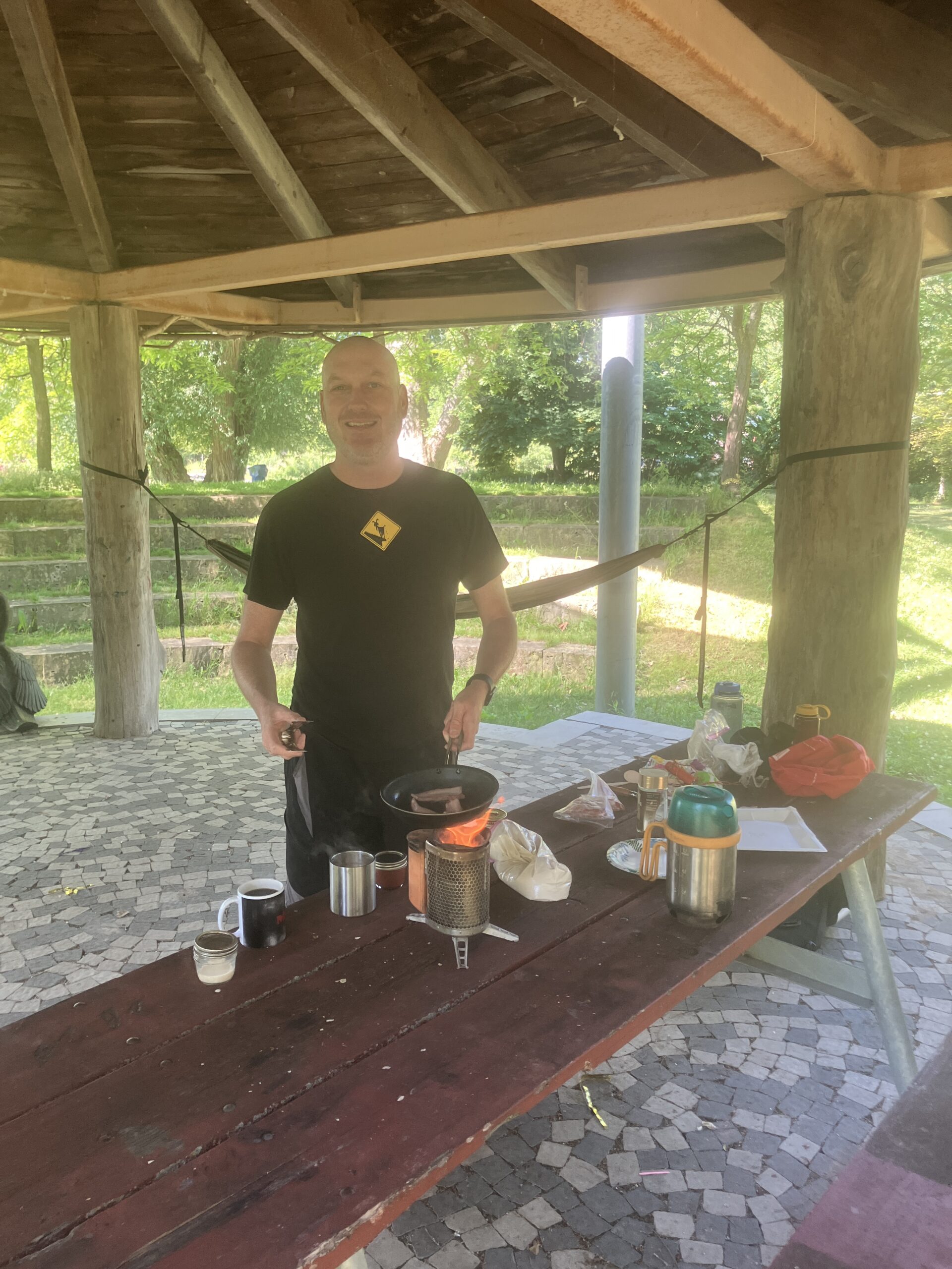
I had never taken a bicycle to the Toronto Island before, so yesterday I went with my friend Lance to ride the different tracks:

He also very kindly made us bannock, coffee, and bacon on his portable twig stove, and even brought along hammocks and lent me one after:
Soon, some friends are planning to ride up the Humber from Old Mill station toward the West Humber trail and Claireville conservation area.