
Author: Milan
In the spring of 2005, I graduated from the University of British Columbia with a degree in International Relations and a general focus in the area of environmental politics. Between 2005 and 2007 I completed an M.Phil in IR at Wadham College, Oxford. I worked for five years for the Canadian federal government, including completing the Accelerated Economist Training Program, and then completed a PhD in Political Science at the University of Toronto in 2023. View all posts by Milan
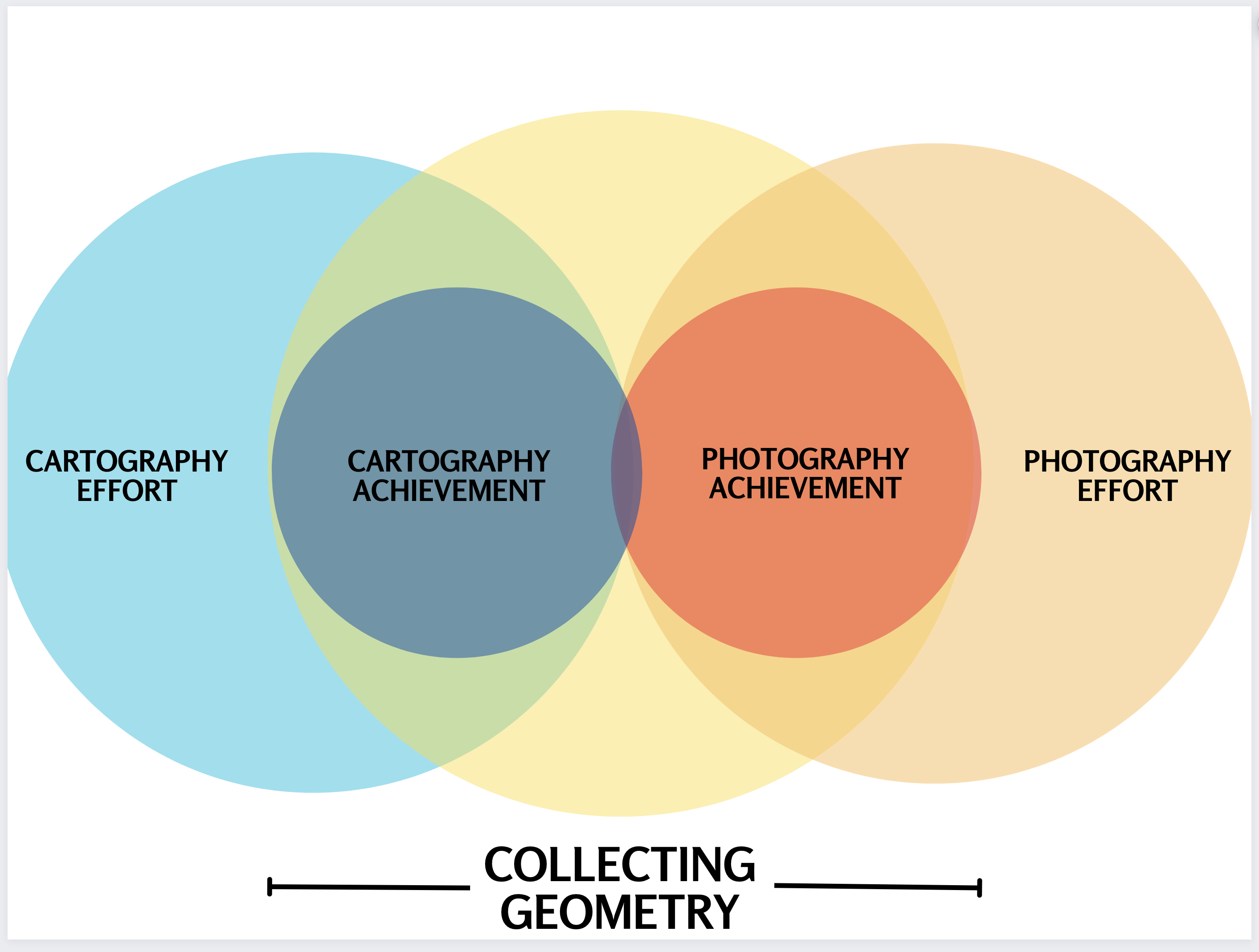
This Venn diagram is meant to convey:
Both “photography” and “cartography” are commonly used to refer both to a set of activities or a vocation, as well as and alternatively, the material products of those vocations. “Photography” is “taking photos” but also “the photos someone has taken”. You can spend a day making an effort at photography, but if you then accidentally expose your film to the sun or erase your memory card, you won’t have any photographic achievement to transmit to anyone else and propagate into the world.
So, there are large and small blue circles for cartography, with the larger lighter area showing the total human effort dedicated to cartography, regardless of whether it produced and maps or geographic information of subsequent use to someone else. For photography there is likewise in orange a paler circle showing all the human effort expended on attempts to capture photographs, with the darker orange enclosed circle representing the information and art which has been successfully captured and shared.
The cartography and photography sides are meant to overlap in a small measure because the successful exercise of each involves at least a bit of the other. Planning out the spacing of a photo shoot and managing the practicalities of putting yourself, your lenses, and sensors in the vicinity of what is to be documented is inevitably in part an exercise in navigating the world, and thus making use of our internal cartography.
Cartography likewise at a minimum includes at least some photography, since cameras are invaluable for the efficient and detailed collection of information about the land and life upon it. We think of humanity as first seeing the world united when people and robots saw the whole blue marble of the Earth from orbit and then the moon.
The main original concept this diagram is meant to convey is that the entirety of both cartography and photography when realized in a shareable form consists of the collection of geometry. A photograph with no geometry could be at best solid black or white. Inevitably the composition, production, evaluation, and appreciation of photography consists of using the human visual system to take in a pattern reproducing light collected at a different place and time using photochemistry or a digital sensor.
Cartography in the sense of physically exploring the world feels a lot like collecting geometry literally.
When I pass a crossroads I like to mark both routes, both to help me spot possible connections when using old routes for route planning in the field, and because it will later help me and users of the map confirm that geometric features of the track that I am drawing will align with those of the landscape, whether it is depicted using something like aerial photography as a basemap or even from their own recognition of the comparative geometry of forms when looking at a highly familiar landscape traced in detail, like the pedestrian inner outlines of a major city.
I likewise will try to highlight recognizable geographic features like coastlines and riversides — and if I find a big circle on the trail you can bet I will walk around it, because it will provide a visually recognizable feature to cross-link the data layer of the GPS track of my walk with any basemap or underlying imagery applied later in mapmaking.
In brief, cartography and photography are related. They are each ventures as well as repositories of human knowledge and culture, and the realization of each involves some element of the other. Most importantly, the photographs and maps we produce can be interpreted and compared using the idea of “collecting geometry” as a summary for what photographers and cartographers achieve.
https://www.flickr.com/photos/sindark/11609309854/in/album-72157625934623682/